
VyzAIpresented by H&M Strategic Holdings Request the detailed spec sheet
Preview draft Overview
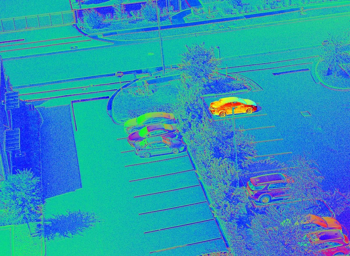
The real shape view from a VyzAI flight: an aerial parking lot where every surface is colored by its angle, cars standing out in orange and magenta against cyan and blue asphalt.

Presented by H&M Strategic Holdings

VyzAI The shape of everything it sees.

VyzAI is a drone sensor that measures the 3D shape of every surface it sees, passively, through one lens.

Request the detailed spec sheet
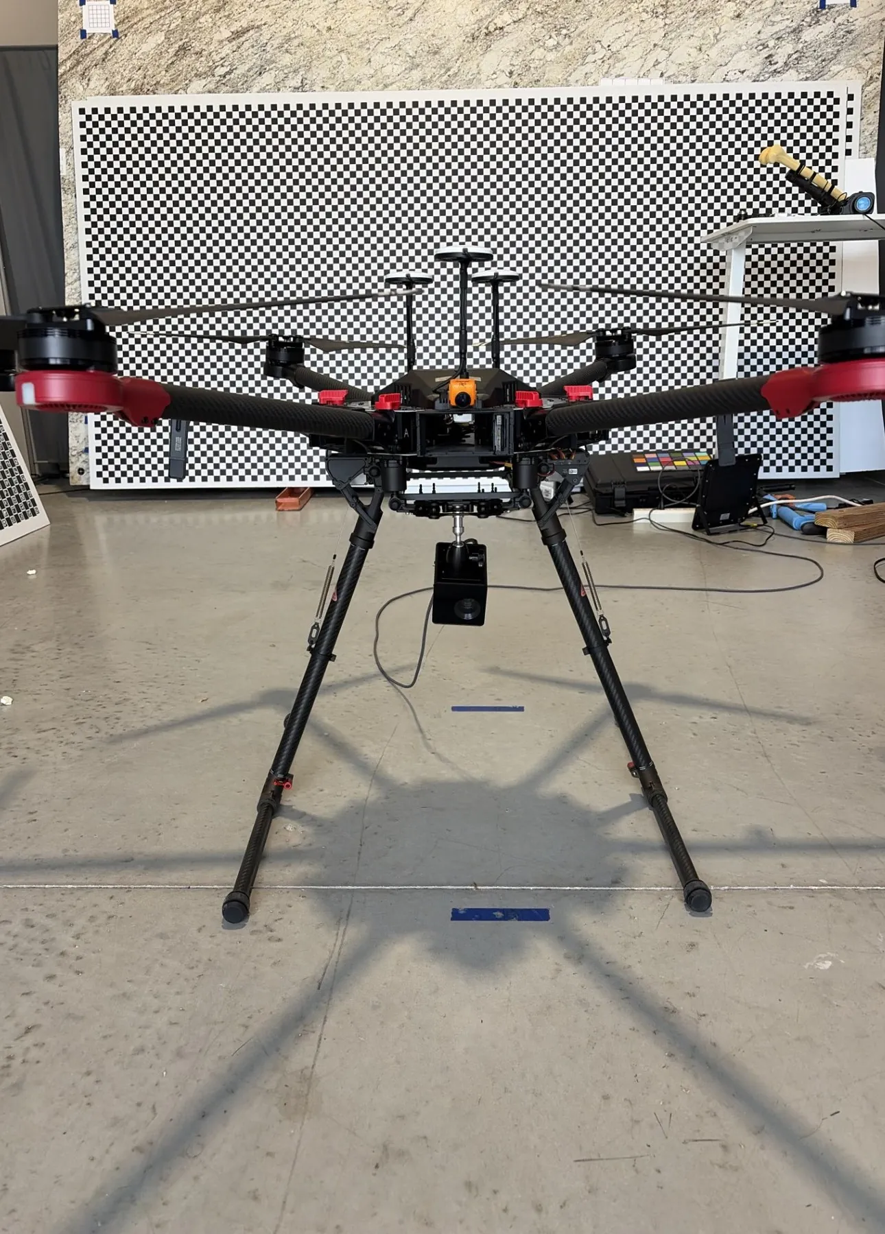
The test hexacopter on a stand in the lab, with the VyzAI module hanging beneath it on a ball mount.

01 Lift

One box, under the airframe.

A commercial hexacopter lifts it to working height.
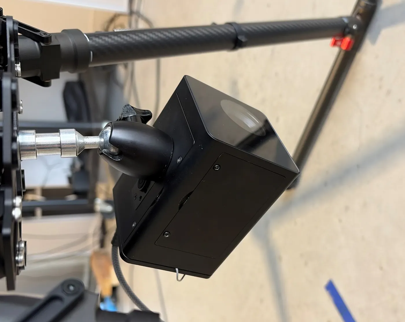
The VyzAI module, a small black box with one lens, on a ball mount under a carbon drone arm.

02 Field of view

A 74° field of view.

One 35 mm lens covers a 74° field of view. The sensor is fully passive and works from ambient light.
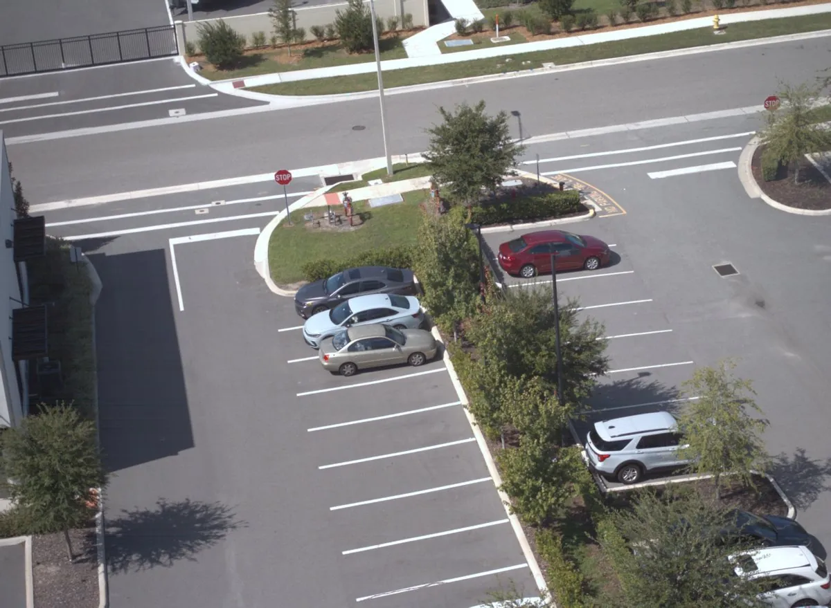
The aerial parking lot frame in plain color, as the unit saw it.

03 Shape

Color gives way to shape.

Every surface shows its own angle. Shape picks out what color misses: vehicles under tree canopy, ground through shadow, and same-color targets against same-color backgrounds.
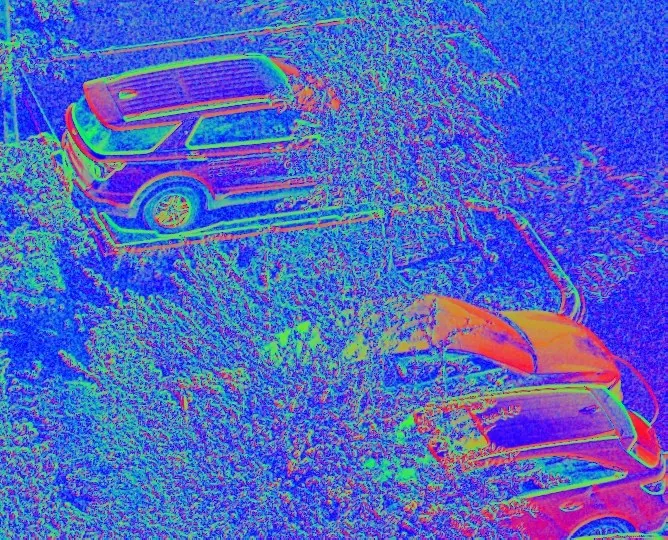
Cars under a tree in the shape view, their outlines clear through the canopy.

04 Detect

Detection, ID and range for every person and vehicle.

On the drone, in real time, it detects people and vehicles, gives each an ID, and ranges and places them on a map, fully passively. Passive range of 60 to 150 m has been shown in flight.
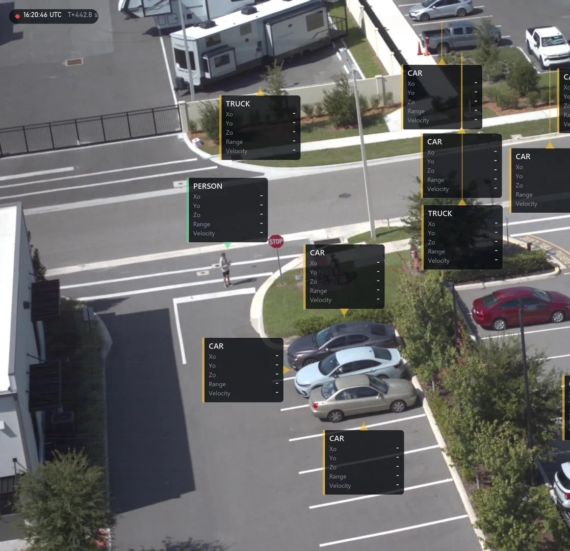
A flight frame with 13 labelled objects.

Close up

The VyzAI module.

The VyzAI module, a small black box with one lens, on its ball mount.

05 The module

One self-contained box.

It carries its own processing, positioning, power and storage, and runs independently of the airframe. Daylight to low light, fully passive with no illuminator.

  • 12 MP global shutter color and shape sensor
  • 35 mm lens, 74° field of view
  • IMU with GNSS, INS and RTK
  • Two swappable 18650 cells
  • 2 TB storage
  • 70 × 68 × 97 mm
The VyzAI module on its mount.

Field results

October 2026 test flights.

Flown and measured, October 2026. Two test flights on a commercial hexacopter, every number computed on the unit.
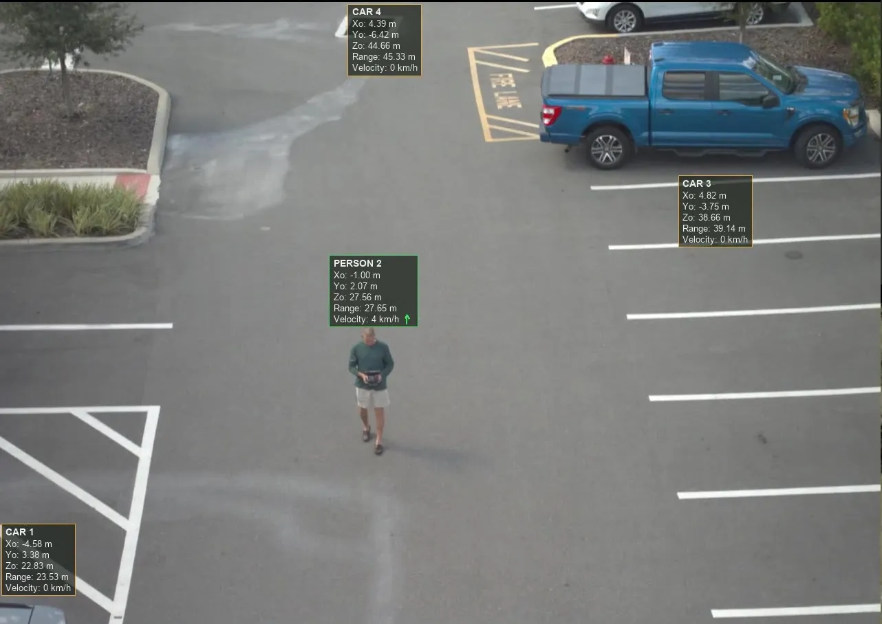
A control app frame from the flight. Three cars and a walking person each carry a label with class, ID, range and velocity.
From the control app, in flight.
An aerial parking lot in plain color. The same frame in the shape view.
One frame, two views. Drag to compare.
  • 61 to 147 mpassive range to people and vehicles, flying 24 to 35 m above ground
  • 13objects labelled in one frame
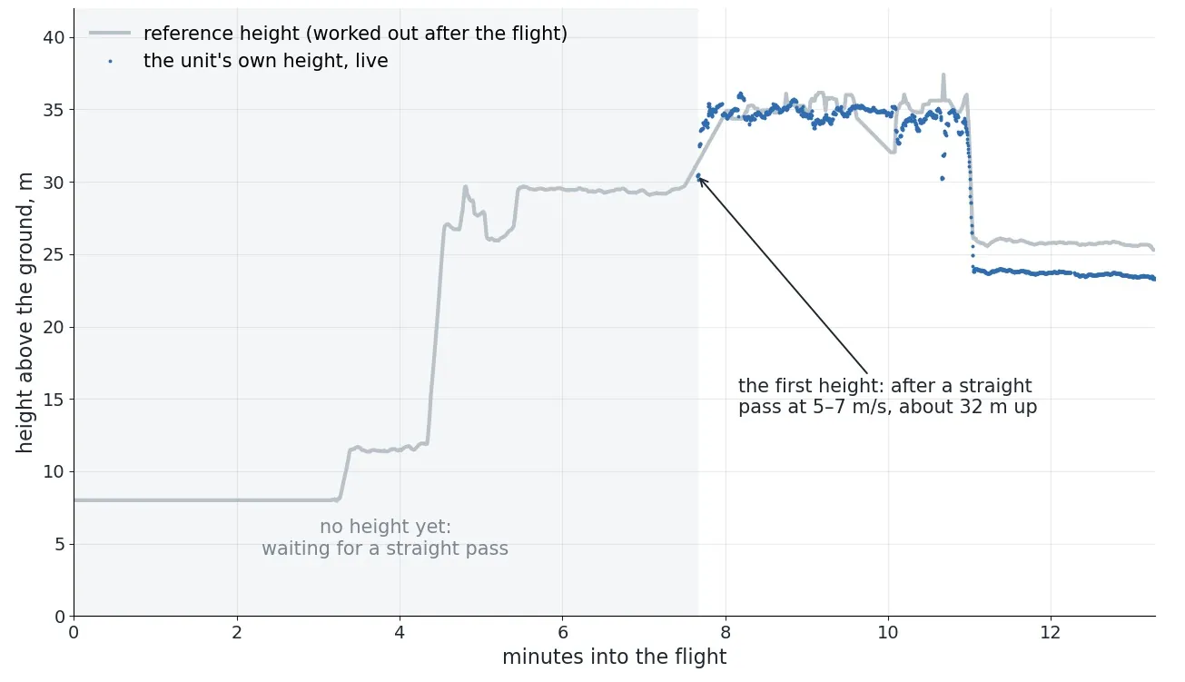
  • Own heightmeasured by the unit itself every frame, with no barometer, held for 1,691 frames in flight
  • 10 sone level pass sets the scale for every distance
Chart of height above ground through a flight. The unit's own live estimate tracks the reference height once a straight pass has set the scale.
The unit's live height against the reference.

In development

  • Glare and reflection removal, live on a ground-vehicle version, moving to the drone next.
  • Shadow suppression.
  • Night operation in motion.
  • Accuracy benchmarks against surveyed ground points.

Who it’s for

Choose the path that fits you.

Pick one to start your request.

  1. 01

    Drone and UGV makers

    One self-contained box for your airframe.

  2. 02

    Integrators

    Its own processing, positioning, power and storage.

  3. 03

    Government agencies

    Passive ISR, force protection and border security. Demonstrations and evaluation units available.

  4. 04

    Direct buyers

    For public safety, security and inspection teams.

Spec sheet

Request the detailed spec sheet.

We'll reply to set up a short call, then share the detailed spec sheet and field data under a mutual NDA.

Preview only. Nothing is sent.

Which path fits you?

U.S. person? optional, for export screening
Request the detailed spec sheet